Pakistan is situated in the western part of the Indian subcontinent, with Afghanistan and Iran on the west, India on the east, and the Arabian Sea on the south. The name Pakistan is derived from the Urdu words PAK (meaning pure) and STAN (meaning country). It is nearly twice the size of California.
Pakistan is divided in three main geographic regions
Northern high lands (contain peaks like K2)
Indus River Plains (one of the world’s most fertile plains )
Balochistan Plateau (contains Gawadar Port , future economic corridor to South Asia)
Northern Highlands
The northern and western highlands of Pakistan contain the towering Karakoram and Pamir mountain ranges, which include some of the world’s highest peaks: K2 (28,250 ft; 8,611 m) and Nanga Parbat (26,660 ft; 8,126 m).
Indus River Plains
An expanse of alluvial plains, the Punjab and Sind, lie to the east. The 1,000-mile-long (1,609 km) Indus River and its tributaries flow through the country from the Kashmir region to the Arabian Sea.
Balochistan Plateau
The Baluchistan Plateau lies to the west and the Thar desert lies in the east.
Climate Of Pakistan
With the exception of the temperate coastal region, most of Pakistan suffers from seasonal extremes of temperature
From June to September, Pakistan has its monsoon season, with warm weather and heavy rain in some areas. The temperatures drop significantly in December through February, while spring tends to be very warm and dry.
Of course, the Karakoram and Hindu Kush mountain ranges are snowbound for much of the year, due to their high altitudes.
Temperatures even at lower elevations may drop below freezing during the winter, while summer highs of 40°C (104°F) are not uncommon. The record high is 55°C (131°F).
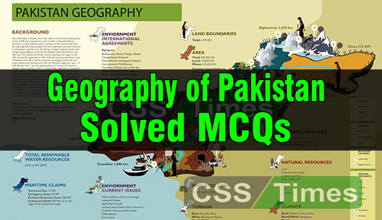
Geography of Pakistan (Solved MCQs)
1. What is the total area of Pakistan?
(a) 796,096 sq km (Correct)
(b) 797,096 sq km
(c) 798,094 sq km
(d) 799,097 sq km
2. What is the total area of Punjab?
(a) 168,122 sq km
(b) 270232 sq km
(c) 205344 sq km (Correct)
(d) 255344 sq km
3. What is the total area of Sindh?
(a) 149,424 sq km
(b) 158,532 sq km
(c) 122,532 sq km
(d) 140,914 sq km (Correct)
4. What is the total area of Baluchistan?
(a) 347,190 sq km (Correct)
(b) 329,190 sq km
(c) 335,190 sq km
(d) 205,344 sq km
5. What is the total area of KPK?
(a) 76,464 sq km
(b) 74968 sq km
(c) 74,521 sq km (Correct)
(d) 72968 sq km
6. What is the total area of Islamabad?
(a) 906 sq km (Correct)
(b) 915 sq km
(c) 911 sq km
(d) 915 sq km
7. What is the total area of FATA?
(a) 28582 sq km
(b) 27,220 sq km (Correct)
(c) 28265 sq km
(d) 28955 sq km
8. Pakistan lies between the latitudes
(a) 24N to 37N (Correct)
(b) 56N to 66N
(c) 25N to 36N
(d) None of these
9. Pakistan lies between the longitudes
(a) 61E to 75.5E (Correct)
(b) 61.3E to 74.1E
(c) 66E to 78.8E
(d) 63E to 73.8E
10. Name the range which separates Pakistan from Afghanistan?
(a) Hindu Kush Range (Correct)
(b) Himalayas Range
(c) Pamir Range
(d) Karakoram Range
11. What is the height of Tirich Mir peak?
(a) 7690 meters (Correct)
(b) 7650 meters
(c) 7670 meters
(d) 7640 meters
12. What is the height of Nanga Parbat peak?
(a) 8116 meters
(b) 8126 meters (Correct)
(c) 8186 meters
(d) 8101 meters
13. Which of the following mountain peaks is called Killer Mountain?
(a) Nanga Parbat (Correct)
(b) Pamir
(c) K-2
(d) Rakaposhi
14. What is the total length of Siachen glacier?
(a) 63 km
(b) 67 km
(c) 71.5 km
(d) 72.5 km (Correct)
15. Baltoro glacier is situated in the mountain range of
(a) Karakoram (Correct)
(b) Sulaiman
(c) Hindu Kush
(d) Himalayas
16. Which Pass connects Chitral with Gilgit and is just 381 meters long?
(a) Lawari Pass
(b) Shangla Pass
(c) Malakand Pass
(d) Shaundur Pass (Correct)
17. Which of the following pass connects Abbotabad and Gilgit?
(a) Babusar Pass (Correct)
(b) Tochi Pass
(c) Bolan Pass
(d) Dargai Pass
18. Which of the following pass connects Peshawar with Chitral?
(a) Malakand Pass (Correct)(b) Dargai Pass
(c) Bolan Pass
(d) Baroghill Pass
19. Manchhar Lake is found in
(a) Thatta district
(b) Khushab District
(c) Dadu District (Correct)
20. Famous Lake Saif-ul-Maluk is situated in
(a) Ziarat
(b) Swat
(c) Baltistan
(d) Kaghan (Correct)
21. The largest Lake of Pakistan is
(a) Sat Para
(b) Kachura
(c) Manchhar (Correct)
(d) None of these
22. In which District of Punjab Kallar Kahar Lake is situated?
(a) Jhelum
(b) Chakwal (Correct)
(c) Sargodha
(d) Mianwali
23. Sat Para lake is situated in
(a) Baltistan (Correct)
(b) Gilgit
(c) Kaghan
(d) Bolan Valley
24. Which of the following pass connects Dir and Chitral?
(a) Lawari Pass (Correct)
(b) Babusar Pass
(c) Bolan Pass
(d) Daragai Pass
25. Which of the following pass connects Sindh Plain with Quetta?
(a) Boroghill Pass
(b) Kilik Pass
(c) Khan Kun Pass
(d) Bolan Pass (Correct)
26. Which of the following pass connects Chitral with Wahkan?
(a) Baroghil Pass (Correct)
(b) Mataka Pass
(c) Muztagh Pass
(d) Dorah Pass
27. Name the area which separates Pakistan from Central Asian States
(a) Pamir Knot
(b) Wakhan (Correct)
(c) Khyber Pass
(d) None of these
28. The Border between Pakistan and Afghanistan is called
(a) Durand line (Correct)
(b) 24th parallel line
(c) Sir Radcliffe line
(d) None of these
29. What is the total area of Azad Kashmir?
(a) 13,926 sq km
(b) 13,496 sq km
(c) 13,493 sq km
(d) 13,297 sq km (Correct)
30. What is the total length of Pak-China boundary line?
(a) 595 kilometers (Correct)
(b) 605 kilometers
(c) 795 kilometers
(d) 805 kilometers
31. What is the total length of Pak-Afghan boundary line?
(a) 2450 kilometers
(b) 2252 kilometers (Correct)
(c) 2350 kilometers
(d) 2218 kilometers
32. What is the total length of Pak-Iran boundary line?
(a) 595 kilometers
(b) 695 kilometers
(c) 795 kilometers
(d) 805 kilometers (Correct)
33. Which is the largest desert of Pakistan?
(a) Thal
(b) Thar (Correct)
(c) Cholistan
(d) Naran
34. Which is located North and North East of Pakistan?
(a) Iran
(b) India
(c) China (Correct)
(d) Afghanistan
35. Which is located East of Pakistan?
(a) Afghanistan (a) China
(c) Iran
(d) India (Correct)
36. Which is located West of Pakistan?
(a) Afghanistan (Correct)
(b) China
(c) Iran
(d) India
37. Which is located in South of Pakistan?
(a) Indian Ocean (Correct)
(b) India
(c) China
(d) Russia
38. Which is the hottest place in Pakistan?
(a) Sibi
(b) Kashmor
(c) Jacobabad (Correct)
(d) Mianwali
39. Which of following places is the rainiest of Pakistan?
(a) Murree (Correct)
(b) Rawalpindi
(c) Karachi
(d) Quetta
40. Area around the rivers is known as
(a) Doaab
(b) Bar
(c) Bela (Correct)
(d) Flood plain
41. Pakistan’s plains are divided into
(a) Two (Correct)
(b) Three
(c) Four
(d) Five
42. The upper Indus plain starts from
(a) Kalabagh (Correct)
(b) Sahiwal
(c) Jhang
(d) Multan
43. The upper Indus plain ends at
(a) Mithankot (Correct)
(b) Multan
(c) Karachi
(d) Thatta
44. The lower Indus plain starts from
(a) Mithankot (Correct)
(b) Multan
(c) Karachi
(d) Thatta
45. The highest peak of the Koh-e-Sufaid range is
(a) Sakasar
(b) Skaram (Correct)
(c) Broad Peak
(d) Rakaposhi
46. Which is the highest peak of Himalayas range in Pakistan?
(b) Nanga Parbat (Correct) (d) Rakaposhi
(c) K-2 (Correct)
(d) Nanga Parbat
47. The highest peak of Karakoram Range is
(a) Pamir
(b) Nanga Parbat
(c) K-2 (Correct)
(d) Rakaposhi
48. Bahawalpur is mostly consists of
(a) Flood
(b) Doaaba
(c) Desert (Correct)
(d) Plateau areas
49. The climate of Pakistan is mostly referred as
(a) Hot and dry (Correct)
(b) Hot and moist
(c) Cold and dry
(d) None of these
50. In which province of the Pakistan there is no desert?
(a) K.P (Correct)
(b) Baluchistan
(c) Sindh
(d) Punjab
51. In which province of Pakistan, the desert of Thal lies?
(a) Punjab (Correct)
(b) Sindh
(c) K.P
(d) Baluchistan
52. In which province of Pakistan, the desert of Thar lies?
(a) Baluchistan
(b) Sindh (Correct)
(c) K.P
(d) Punjab
53. K-2 is also Known as:
(a) Goodwin Austin (Correct)(b) Broad Peak
(c) Roshan Peak
(d) Sia Kingri
54. What is the total height of K-2 peak?
(a) 8610 meter
(b) 8640 meter
(c) 8611 meter (Correct)
(d) 8691 meter
55. Name the Glacier which is located in Karakoram mountain range?
(a) Siachen, Hispar
(b) Batura, Biafo
(c) Chogo Lungma
(d) All of above (Correct)
56. What is the total generation capacity of Warsak Dam?
(a) 240 MW
(b) 240 MW (Correct)
(c) 300 MW
(d) None of these
57. Tarbela Dam was constructed in
(a) 1972
(b) 1976 (Correct)
(c) 1971
(d) 1978
58. The highest peak of Hindu Kush range is
(a) Tirich Mir (Correct)
(b) Nanga Parbat
(c) K-2
(d) Rakaposhi
59. The highest peak of Salt range is
(a) Sakasar (Correct)
(b) Nanga Parbat
(c) K-2
(d) Rakaposhi
60. Name the longest glacier of Pakistan?
(a) Hispar
(b) Baltoro
(c) Siachen (Correct)
(d) Batura
61. Chiantar glacier is located in the region of
(a) Shigar
(b) Baltistan
(c) Sakardu
(d) Chitral (Correct)
62. How many peaks in Pakistan are higher than 8,000 meters?
(a) 4
(b) 3
(c) 5 (Correct)
(d) 2
63. The highest of Koh-e-Sulaiman range is
(a) Tirichmir
(b) K-2
(c) Takhat-e-Sulaiman (Correct)
(d) Sakar
64. Siachen glacier is located in the region of
(a) Shigar
(b) Chitral
(c) Skardu
(d) Baltistan (Correct)
65. K-2 is present in which mountains range?
(a) Pamir
(b) Hindu Kush
(c) Karakoram (Correct)
(d) Himalayas
66. Nanga Parbat is located in
(a) Hindu Kush
(b) Karakoram
(c) Pamir
(d) Himalayas (Correct)
67. Which is the highest peak of Pakistan?
(a) Pamir
(b) Nanga Parbat
(c) K-2 (Correct)
(d) Rakaposhi
68. Which is the second highest peak of the world?
(a) Pamir
(b) Nanga Parbat
(c) K-2 (Correct)
(d) Rakaposhi
69. Which range separates China from Pakistan?
(a) Hindu Kush Range
(b) Pamir Range
(c) Himalayas Range
(d) Karakoram Range (Correct)
70. Which of the following pass connects Dera Ismail Khan with Ghazni (Afghanistan)?
(a) Dargai Pass
(b) Bolan Pass
(c) Gomal Pass (Correct)
(d) Tochi Pass
71. Which of the following pass connects Chitral with Wahkan?
(a) Muztagh Pass
(b) Malakand Pass
(c) Khan Kun Pass (Correct)
72. Which of the following pass connects Qila Abdullah with Cheman?
(a) Mintaka Pass
(b) Khojak Pass (Correct)
(c) Dorah Pass
(d) Muztagh Pass
73. The first gas field discovered in Pakistan in 1952 was at
(a) Mial
(b) Sui (Correct)
(c) Pirkoh
(d) None of these
74. Which province is the largest producer of natural gas?
(a) Sindh (Correct)
(b) Baluchistan
(c) Punjab
(d) None of these
75. Which province is the largest producer of oil?
(a) Punjab (Correct)
(b) Sindh
(c) Baluchistan
(d) None of these
76. Deltas plain of Pakistan starts from
(a) Mithankot
(b) Multan
(c) Karachi
(d) Thatta (Correct)
77. When Mangla Dam was completed?
(a) 1968
(b) 1970
(c) 1969
(d) 1967 (Correct)
78. What is the total height of Khunjrab Pass?
(a) 4451 meters
(b) 4555 meters (Correct)
(c) 4671 meters
(d) 4918 meters
79. Which of the following pass connects Baltistan and Yarkand (China)?
(a) Muztagh Pass (Correct)
(b) Peiwar Kotal Pass
(c) Malakand Pass
(d) Khan Kun Pass
80. Which Pass is the highest Pass of Pakistan?
(a) Khunjrab Pass
(b) Malakand Pass
(c) Muztagh Pass (Correct)
(d) Khan Kun Pass
81. Which of the following pass connects Bannu (Pakistan) and Ghazni (Afghanistan)?
(a) Tochi Pass (Correct)
(b) Bolan Pass
(c) Daragai Pass
(d) Kilik Pass
82. Which of the following pass connects Mardan with Malakand?
(a) Gomal Pass
(b) Dargai Pass (Correct)
(c) Tochi Pass
(d) Dorah Pass
83. Which of the following pass connects Peshawar with Afghanistan?
(a) Bolan Pass
(b) Gomal Pass
(c) Lawari Pass
(d) Khyber Pass (Correct)
84. Which is the largest fresh water lake of Pakistan?
(a) Manchhar Lake (Correct)(b) Kaghan Lake
(c) Sat Para Lake
(d) None of these
85. In which Valley Lalusar Lake is located?
(a) Kaghan (Correct)
(b) Gilgit
(c) Baltistan
(d) None of these
86. Which Lake is located near Thatta (Sindh)?
(a) Sat Para
(b) Phander
(c) Keenjher (Correct)
(d) Hanna
87. Rawal Lake is situated in
(a) Islamabad (Correct)
(b) Peshawar
(c) Quetta
(d) None of these
88. Khewra is famous for the minerals of
(a) Iron
(b) Chromium
(c) Salt (Correct)
(d) None of these
89. Toot oil and natural gas field is located in
(a) Sindh
(b) Baluchistan
(c) NWFP
(d) Punjab (Correct)
90. Koh-i-Sultan is located in
(a) Punjab
(b) Sindh
(c) Baluchistan (Correct)
(d) NWFP
91. Ghulam Muhammad Barrage was constructed on River:
(a) Kabul
(b) Swat
(c) Jehlum
(d) Indus (Correct)
92. Warsak Project is located on
(a) Gomal River
(b) Karam River
(c) Bera River
(d) Kabul River (Correct)
93. What is the installed generation capacity of Mangla Dam?
(a) 1300 MW
(b) 1400 MW
(c) 1000 MW (Correct)
(d) None of these
94. Wullar Lake is a source of
(a) Jhelum (Correct)
(b) Chenab
(c) Indus
(d) Kabul
95. Hina Lake is situated near
(a) Peshawar
(b) Quetta (Correct)
(c) Murree
(d) Kaghan
96. Kalar Kahar Lake is situated in
(a) Kirthar Range
(b) Salt Range (Chakwal) (Correct)
(c) Koh-e-Sufaid Range
(d) None of these
97. Hub Lake is situated near
(a) Quetta
(b) Peshawar
(c) Karachi (Correct)
(d) Gomal
98. Haleji Lake is situated in
(a) Punjab
(b) Sindh (Correct)
(c) K.P
(d) Balochistan
99. Kachura Lake is situated in
(a) Gilgit
(b) Kaghan Valley
(c) Skardu (Correct)
(d) None of these
100. Which of the following lake is called “Paradise of Birds”?
(a) Hub Lake
(b) Manchhar Lake
(c) Haleji Lake (Correct)
(d) None of these
101. Which is the man made largest Lake of Pakistan?
(a) Hub Lake
(b) Changa Manga Lake
(c) Keenjhar Lake (Correct)
(d) None of these
102 Kabul River is located in the Province
(a) Baluchistan
(b) Punjab
(c) K.P (Correct)
(d) Sindh
103. Name the nearest city from where Indus begins its deltaic stage and breaks into many distributaries.
(a) Kotri
(b) Thatta (Correct)
(c) Sukkur
(d) Daddu
104. What is the total length of Jehlum River?
(a) 780 km
(b) 725 km (Correct)
(c) 825 km
(d) 910 km
105. The Potwar plateau is very rich in
(a) Oil and gas (Correct)
(b) Chromite
(c) Aluminum
(d) None of these
106. Warchha mine is famous for the mineral of
(a) Iron
(b) Salt (Correct)
(c) Sulphur
(d) None of these
107. Longest tunnel of Pakistan is
(a) Tarbela
(b) Khojak (Correct)
(c) Kalal Bagh
(d) None of these
108. On which river Mangla Dam is built?
(a) Indus
(b) Chenab
(c) Jhelum (Correct)
(d) None of these
109. What is the total length of Ravi River?
(a) 610 km
(b) 635 km
(c) 695 km
(d) 715 km (Correct)
110. Panjgora River is located in the Province of
(a) Punjab
(b) Sindh
(c) K.P (Correct)
(d) Baluchistan
111. How many rivers flow in Punjab Province?
(a) Four
(b) Five (Correct)
(c) Six
(d) Seven
112. ‘Marala’ Headworks has been constructed on River;
(a) Ravi
(b) Chenab (Correct)
(c) Sutlej
(d) Indus
113. What is the installed hydroelectricity generation capacity of Tarbela?
(a) 3478 MW (Correct)
(b) 3378 MW
(c) 3578 MW
(d) 3278 MW
114. Sulemanki Headworks is constructed on the river
(a) River Ravi
(b) River Chenab
(c) River Sutlej (Correct)
(d) None of these
115. Trimmu Sidhnai canal takes water from Trimmu Barrage and discharges it into
(a) Ravi (Correct)
(b) Chenab
(c) Upper Beri Doaab
(d) Lower Beri Doaab
116. The Chashma Nuclear plant was built with the help of
(a) France
(b) Germany
(c) Canada
(d) China (Correct)
117. Bolan River is located in the Province of
(a) Baluchistan (Correct)
(b) Sindh
(c) K.P
(d) Punjab
118. How many rivers are present in Pakistan?
(a) 20
(b) 22
(c) 23
(d) 24 (Correct)
119. Zhob and Mula rivers are located in
(a) Potwar Plateau
(b) Baluchistan Plateau (Correct)
(c) Salt Range
120. Jhelum and Chenab rivers merge at
(a) Rasol Pur Headworks
(b) Trimmu Headworks (Correct)
(c) Panjnad Headworks
(d) None of these
121. The Indus River rises from
(a) China
(b) Tibet (Correct)
(c) Jammu
(d) None of these
122. Which is the longest river of Baluchistan Province?
(a) Bolan
(b) Hingol (Correct)
(c) Dasht
(d) Rukshan
123. Soan and Haro are famous rivers of
(a) Potwar Plateau (Correct)
(b) Baluchistan Plateau
(c) Hindu Kush Range
(d) None of these
124. Which river is called “Nile of Pakistan”?
(a) Chenab River
(b) Indus River (Correct)
(c) Ravi River
(d) None of these
125. Where all rivers of Punjab enter into Indus?
(a) Panjnad
(b) Trimmu
(c) Mitthankot (Correct)
(d) Kabir Wala
126. Which is the smallest river of Pakistan?
(a) Ravi (Correct)
(b) Sutlej
(c) Chenab
(d) Jehlum
127. Name the most polluted river of Pakistan
(a) Ravi (Correct)
(b) Indus
(c) Kabul
(d) None of these
128. Which area has the biggest deposits of copper?
(a) Chagi (Correct)
(b) Muslim bagh
(c) Kalabagh
(d) None of these
129. Chaghi copper deposits are found in the province
(a) Punjab
(b) Sindh
(c) Baluchistan (Correct)
(d) None of these
130. Zain, Mari are famous for the
(a) Gas fields (Correct)
(b) Oil fields
(c) Gypsum
(d) None of these
131. Saindak project is producing copper, silver and
(a) Iron
(b) Gold (Correct)
(c) Lead
(d) None
132. Which is the biggest natural gas field of Pakistan?
(a) Dhulian (Punjab)
(b) Sui (Baluchistan) (Correct)
(c) Khand Kot (Sindh)
(d) None of these
133. Which of the following specious metal is found in Dera Ghazi Khan?
(a) Platinum
(b) Uranium (Correct)
(c) Thorium
(d) None of these
134. Sulphur is found in the areas of Pakistan
(a) Chitral
(b) Koh-i-Sultan (Correct)
(c) Hyderabad
(d) None of these
135. Which is the oldest hydroelectricity project in Pakistan?
(a) Mangla
(b) Tarbela
(c) Warsak
(d) Malakand Dargai (Correct)
136. Under Indus Water Treaty which rivers were given to India?
(a) Ravi and Beas
(b) Indus, Jhelum and Chenab
(c) Sutlej, Ravi (Correct)
(d) None of these
137. Under Indus Water Treaty the rivers given to Pakistan are
(a) Indus Jhelum and Chenab (Correct)
(b) Indus and Jhelum
(c) Ravi and Beas
(d) None of these
138. Balloki Headworks was built on the river
(a) Ravi (Correct)
(b) Sutlej
(c) Bias
(d) Jhelum
139. Upper Chenab Canal takes off from
(a) Head Sulaimanki
(b) Head Marala (Correct)
(c) Head Khanki
(d) None of these
140. Diamer Bhasha dam will produce electricity after completing
(a) 4200 MW
(b) 4500 MW (Correct)
(c) 4800 MW
(d) 6000 MW
141. Which is the biggest earth filled dam in the world?
(a) Tarbela (Correct)
(b) Mangla
(c) Hub
(d) None of these
142. What is the installed capacity of Chashma Nuclear Plant?
(a) 3.20 MW
(b) 32.8 MW
(c) 325 MW (Correct)
(d) None of these
143. Warsak multi project was started in
(a) 1960 (Correct)
(b) 1965
(c) 1962
(d) None of these
144. When the Indus Water Treaty was signed?
(a) 19th September 1960 (Correct)
(b) 19th September 1952
(c) 19th December 1975
(d) None of these
145. What is the installed electric generating capacity of nuclear plants?
(a) 787 MW (Correct)
(b) 510 MW
(c) 415 MW
(d) None of these
146. The origin of Upper Bari Doab Canal is
(a) Chenab (Correct)
(b) Jhelum
(c) Ravi
(d) None of these
147. Name the longest river of Pakistan
(a) Indus (Correct)
(b) Kabul
(c) Chenab
(d) None of these
148. What is the total length of Indus River?
(a) 2700 km
(b) 2800 km
(c) 2896 km (Correct)
(d) 2935 km
149. Dasht River is located in
(a) KPK
(b) Punjab
(c) Sindh
(d) Baluchistan (Correct)
150. Porali River is located in
(a) Baluchistan (Correct)
(b) Punjab
(c) Sindh
(d) KPK
151. Saindak project is producing copper, silver and gold with the help of
(a) China (Correct)
(b) Russia
(c) France
(d) None of these
152. Which of the following are the biggest deposits of coal in Pakistan?
(a) Thar coal deposits (Correct)
(b) Makerwal deposits
(c) Kalabagh deposits
(d) None of these
153. Muslim Bagh which is famous for chromite is located in
(a) KPK
(b) Sindh
(c) Baluchistan (Correct)
(d) None of them
154. Saindak project is famous for
(a) Silver
(b) Copper
(c) Gold
(d) All of these (Correct)
155. The “Basha Dam” on Indus River is being constructed in:
(a) P.K
(b) Northern Areas (Correct)
(c) Punjab
(d) None of these
156. Hangol Dam’ is located in:-
(a) Sindh
(b) FATA
(c) Baluchistan (Correct)
(d) P.K
157. Producing capacity of electricity of Ghazi Barotha Dam is
(a) 1850 MW
(b) 1750 MW
(c) 1925 MW
(d) 1450 MW (Correct)
158. Peshawar district and major part of Mardan district, are consisted of
(a) Hilly areas
(b) Plain areas (Correct)
(c) Plateau areas
(d) None of these
159. Indus plain is divided into
(a) Two
(b) Three
(c) Four (Correct)
(d) Six
160. What is the total length of Pak-India boundary line?
(a) 1610 kilometers (Correct)
(b) 1670 kilometers
(c) 1810 kilometers
(d) None of these
161. What is the total length of coastline of Pakistan?
(a) 1020 km
(b) 1046 km (Correct)
(c) 1095 km
(d) 1126 km
162. Pakistan is connected through Silk Road wit
(a) India
(b) China (Correct)
(c) Afghanistan
(d) None of these
163. The lowest point (below the sea level) of Pakistan is
(a) Indus plain
(b) Thatta
(c) Indian Ocean (Correct)
(d) Lahore
164. The highest point above the sea level in Pakistan is
(a) Pamir
(b) Nanga Parbat
(c) K-2 (Correct)
(d) Rakaposhi
165. Land situated between two rivers is known:
(a) Doab (Correct)
(b) Khaddar
(c) Desert
(d) Bar
Leave a Reply