Categories
GK MCQ’s MCQs

Pakistan Affairs Most Important MCQs (Geography Of Pakistan)

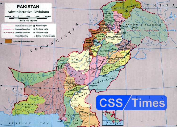
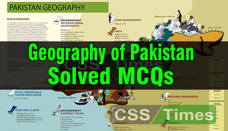
1. The length of Pak-China border is?
(a) 623Km
(b) 527Km
(c) 523 km
(d) 823 km

2. The length of Pak-Afghanistan border is:
(a) 2,330 km
(b) 1,430 km
(c) 2,252 km
(d) 2,430 km

3. The length of Pak-India border is?
(a) 1,912 km
(b) 1800km
(c) 2,612
(d) 2,812km

4. The length of Pakistan-Iran border is?
(a) 709 km
(b) 909 km
(c) 409 km
(d) 809 km

5. The length of coastline of Pakistan is?
(a) 1,748 km
(b) 1,046 km
(c) 1,846km
(d) 1,216 km

Categories
GK MCQ’s

Geography of Pakistan (Solved MCQs) | World General Knowledge Series

Pakistan is situated in the western part of the Indian subcontinent, with Afghanistan and Iran on the west, India on the east, and the Arabian Sea on the south. The name Pakistan is derived from the Urdu words PAK (meaning pure) and STAN (meaning country). It is nearly twice the size of California.

Pakistan is divided in three main geographic regions

Northern high lands (contain peaks like K2)
Indus River Plains (one of the world’s most fertile plains )
Balochistan Plateau (contains Gawadar Port , future economic corridor to South Asia)
Northern Highlands

The northern and western highlands of Pakistan contain the towering Karakoram and Pamir mountain ranges, which include some of the world’s highest peaks: K2 (28,250 ft; 8,611 m) and Nanga Parbat (26,660 ft; 8,126 m).

Categories
Pakistan Affairs World General Knowledge

Geography of Pakistan: The borders of Pakistan

Geography of Pakistan

Pakistan is located in South Asia and is at the junction of Central Asia and Middle East, which gives its location great significance. Pakistan’s total land border is 6,774 kilometres long and it borders four countries. Pakistan borders India in the east, Afghanistan and Iran in the west and China is situated at the northeast. While surrounded by land from three sides, the Arabian Sea lies in the south. Here we will focus on Pakistan’s international borders and some interesting facts about them.